
Back to the library
Dataset
geoBoundaries gbOpen — African administrative divisions ADM0-ADM2
Public ID
ADG-DAT-2026-014
Version
observatory/2026-09-08
Licence
CC-BY-4.0
2005-01-01 — 2022-01-01Period
Regional — West AfricaCoverage
GeoCategory
OpenAccess
71 words · about a minute
Your browser cannot read text aloud. The written text is above.
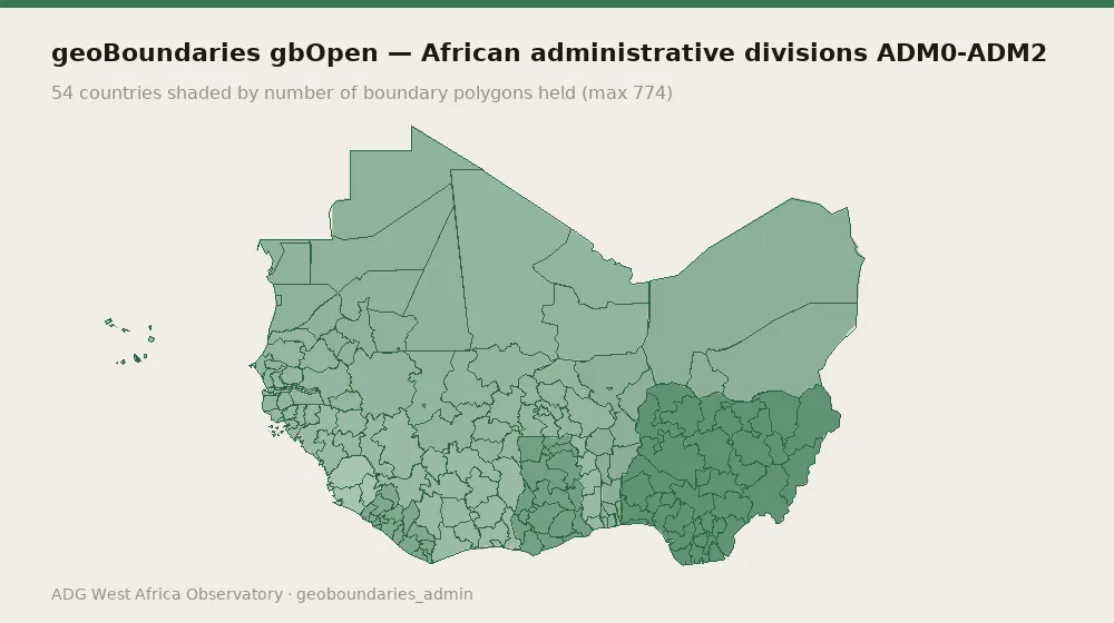
geoBoundaries gbOpen — African administrative divisions ADM0-ADM2. Collected from geoBoundaries (William & Mary geoLab) (academic) on a quarterly cadence. 160 records spanning 2005-01-01 to 2022-01-01, covering GMB, SLE, CPV, BFA, TGO, MRT, LBR, BEN, GNB, NER, CIV, GIN, MLI, NGA, SEN, GHA. Evidence is content-addressed: every record carries a SHA-256 hash of the exact bytes retrieved, the source URL, the date the source published it and the date it was fetched.
Data preview
Real records from the holding. Read the preview before writing a query — it is the fastest way to see what a row actually contains.
Administrative boundary layers — feature counts are polygon counts
| country | layer | level | polygons | vintage | licence |
|---|---|---|---|---|---|
| AGO | Angola | 0 | 1 | 2021 | Creative Commons Attribution-ShareAlike 2.0 |
| AGO | Angola | 1 | 18 | 2021 | Public Domain |
| AGO | Angola | 2 | 157 | 2006 | Public Domain |
| BDI | Burundi | 0 | 1 | 2006 | Public Domain |
| BDI | Burundi | 1 | 18 | 2014 | CC0 1.0 Universal (CC0 1.0) Public Domain Dedication |
| BDI | Burundi | 2 | 119 | 2007 | Public Domain |
Showing 6 of 160 records.
Variables and indicators
records: 160
temporal span: 2005-01-01 to 2022-01-01
countries covered: 16
data kind: geo
evidence class: secondary
licence: CC-BY-4.0
republishable: yes
top countries: GMB (3), SLE (3), CPV (3), BFA (3), TGO (3)
record types: admin_boundary_set (160)
temporal span: 2005-01-01 to 2022-01-01
countries covered: 16
data kind: geo
evidence class: secondary
licence: CC-BY-4.0
republishable: yes
top countries: GMB (3), SLE (3), CPV (3), BFA (3), TGO (3)
record types: admin_boundary_set (160)
Method
Content-addressed collection (SHA-256). Evidence class: secondary / republisher. Cadence: quarterly.
How to cite
ADG Library Editorial (1 January 2022). geoBoundaries gbOpen — African administrative divisions ADM0-ADM2. Axel Dev Group — ADG Library, Dataset ADG-DAT-2026-014. https://library.axeldevlab.com/node/167
@techreport{ADG-DAT-2026-014,
  title       = {{geoBoundaries gbOpen — African administrative divisions ADM0-ADM2}},
  author      = {ADG Library Editorial},
  institution = {Axel Dev Group --- ADG Library},
  type        = {Dataset},
  number      = {ADG-DAT-2026-014},
  year        = {2022},
  url         = {https://library.axeldevlab.com/node/167}
}
TY  - RPRT
TI  - geoBoundaries gbOpen — African administrative divisions ADM0-ADM2
AU  - ADG Library Editorial
PY  - 2022
PB  - Axel Dev Group — ADG Library
M1  - ADG-DAT-2026-014
UR  - https://library.axeldevlab.com/node/167
ER  -