
Retour à la bibliothèque
Jeu de données
geoBoundaries gbOpen — divisions administratives africaines ADM0-ADM2
2005-01-01 — 2022-01-01Period
Regional — West AfricaCouverture
GeoCatégorie
OpenAccès
71 words · about a minute
Your browser cannot read text aloud. The written text is above.
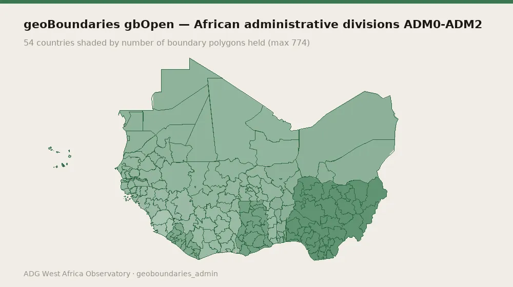
geoBoundaries gbOpen — African administrative divisions ADM0-ADM2. Collected from geoBoundaries (William & Mary geoLab) (academic) on a quarterly cadence. 160 records spanning 2005-01-01 to 2022-01-01, covering GMB, SLE, CPV, BFA, TGO, MRT, LBR, BEN, GNB, NER, CIV, GIN, MLI, NGA, SEN, GHA. Evidence is content-addressed: every record carries a SHA-256 hash of the exact bytes retrieved, the source URL, the date the source published it and the date it was fetched.
Variables and indicators
records: 160
temporal span: 2005-01-01 to 2022-01-01
countries covered: 16
data kind: geo
evidence class: secondary
licence: CC-BY-4.0
republishable: yes
top countries: GMB (3), SLE (3), CPV (3), BFA (3), TGO (3)
record types: admin_boundary_set (160)
temporal span: 2005-01-01 to 2022-01-01
countries covered: 16
data kind: geo
evidence class: secondary
licence: CC-BY-4.0
republishable: yes
top countries: GMB (3), SLE (3), CPV (3), BFA (3), TGO (3)
record types: admin_boundary_set (160)
Method
Content-addressed collection (SHA-256). Evidence class: secondary / republisher. Cadence: quarterly.
How to cite
ADG Library Editorial (1 January 2022). geoBoundaries gbOpen — divisions administratives africaines ADM0-ADM2. Axel Dev Group — ADG Library, Dataset ADG-dataset-167. https://library.axeldevlab.com/fr/node/167
@techreport{ADG-dataset-167,
  title       = {{geoBoundaries gbOpen — divisions administratives africaines ADM0-ADM2}},
  author      = {ADG Library Editorial},
  institution = {Axel Dev Group --- ADG Library},
  type        = {Dataset},
  number      = {ADG-dataset-167},
  year        = {2022},
  url         = {https://library.axeldevlab.com/fr/node/167}
}
TY  - RPRT
TI  - geoBoundaries gbOpen — divisions administratives africaines ADM0-ADM2
AU  - ADG Library Editorial
PY  - 2022
PB  - Axel Dev Group — ADG Library
M1  - ADG-dataset-167
UR  - https://library.axeldevlab.com/fr/node/167
ER  -